Basin Project
Overview
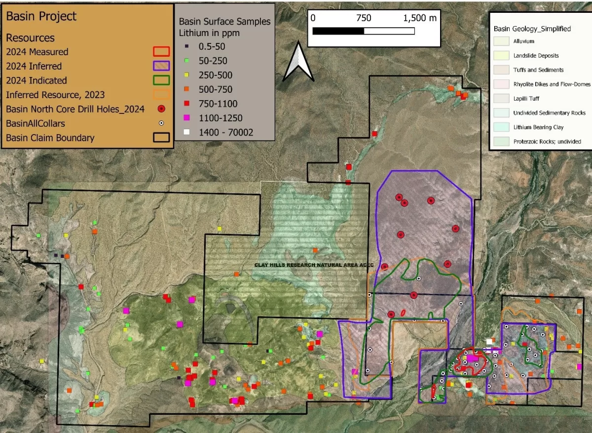
The Basin Project is made up of 3 mining claim blocks on BLM-administered land and 1 lease and 2 mineral exploration permits on state-administered land. In total the project embraces 20.7km2. The project is grouped into Basin East (Basin East, Basin East Extension and Basin North) and Basin West (Basin West and Basin West Extension)

Basin East Project
Description
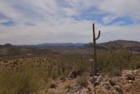
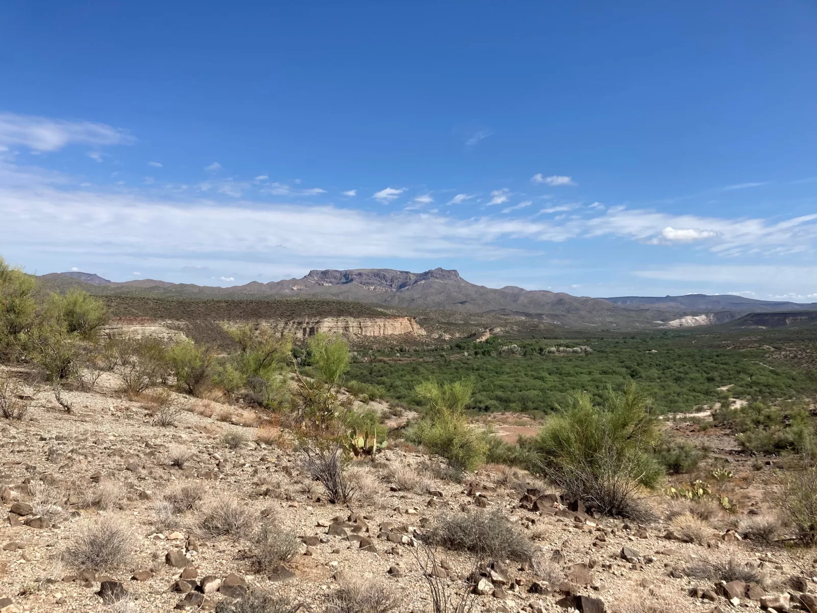
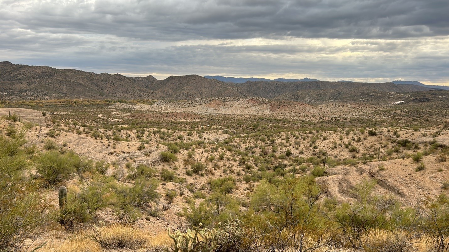
Basin East is located in west-central Arizona, USA, around 6 miles from the operating Bagdad copper mine. The project is favourably located in terms of infrastructure, 6 miles north of Highway 93, a power line and a natural gas pipeline are adjacent to the project area.
The project consists of one mineral lease and two mineral exploration permits on Arizona State land and 215 lode mining claims on federal land administered by the BLM. The entire Basin project area encompasses a total area of 20.7 km2 . Lands are administered by the State of Arizona and Bureau of Land Management, both of whom BHLL has drilling permits in place.
Project highlights
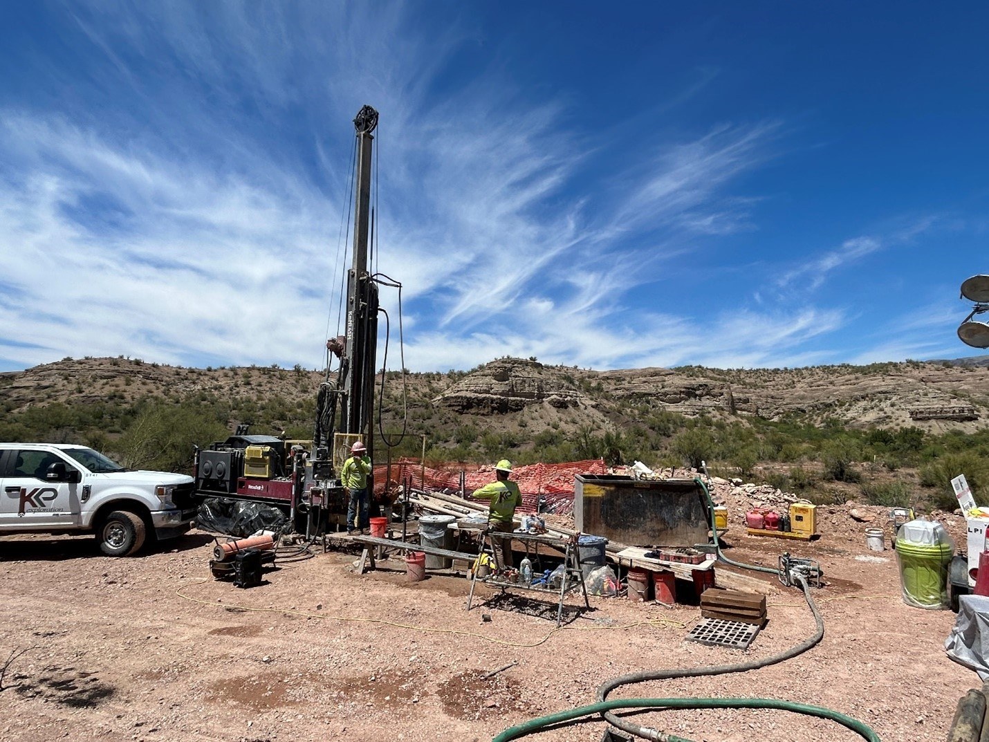
Drilling
To date, drilling programs have been completed during 2018, 2021, 2022, 2023, and most recently in 2024. The 2018-2022 programs were focused on Basin East, resulting in the definition of two separate mineral resource calculations. The second of the two mineral resource estimates (MRE) was completed in late 2022 by SRK Consulting (UK), resulting in the definition of 371kt of lithium carbonate equivalent (LCE) at a grade of 694ppm Li.
A sonic drilling program was commissioned in mid-2023, testing additional portions of Basin East, then expanded north to Basin East Extension (MEP) and a small portion of Basin North. The program was completed with 14 holes and 2,355m of drilling. This drilling was widespread in the MEP and resulted in the tripling of the 2022 resource, from 0.371Mt to 1.08Mt LCE and an increase in grade from 694 to 900 ppm Li.
A core drilling program was commissioned in mid-2024, testing and expanding the resource towards the north on the Basin North BLM claims. A total of 8 widely spaced vertical core holes were completed for a total of 2,353 meters. The purpose of this 2024 core program was to expand the resource northerly where our drilling permit facilitated resource expansion based upon interpretation of extensive clays under post-mineral tuffs and conglomerates. The drilling resulted in a milestone expansion of the MRE from 1.09MT to 2.81MT LCE, easily becoming the largest mineral resource in the state of Arizona. The expansion, exceeding 2.5MT, resulted in the payment to BHLL by Lithium Royalty Company USD $3.0M dollars per the underlying royalty agreement.
Geophysics
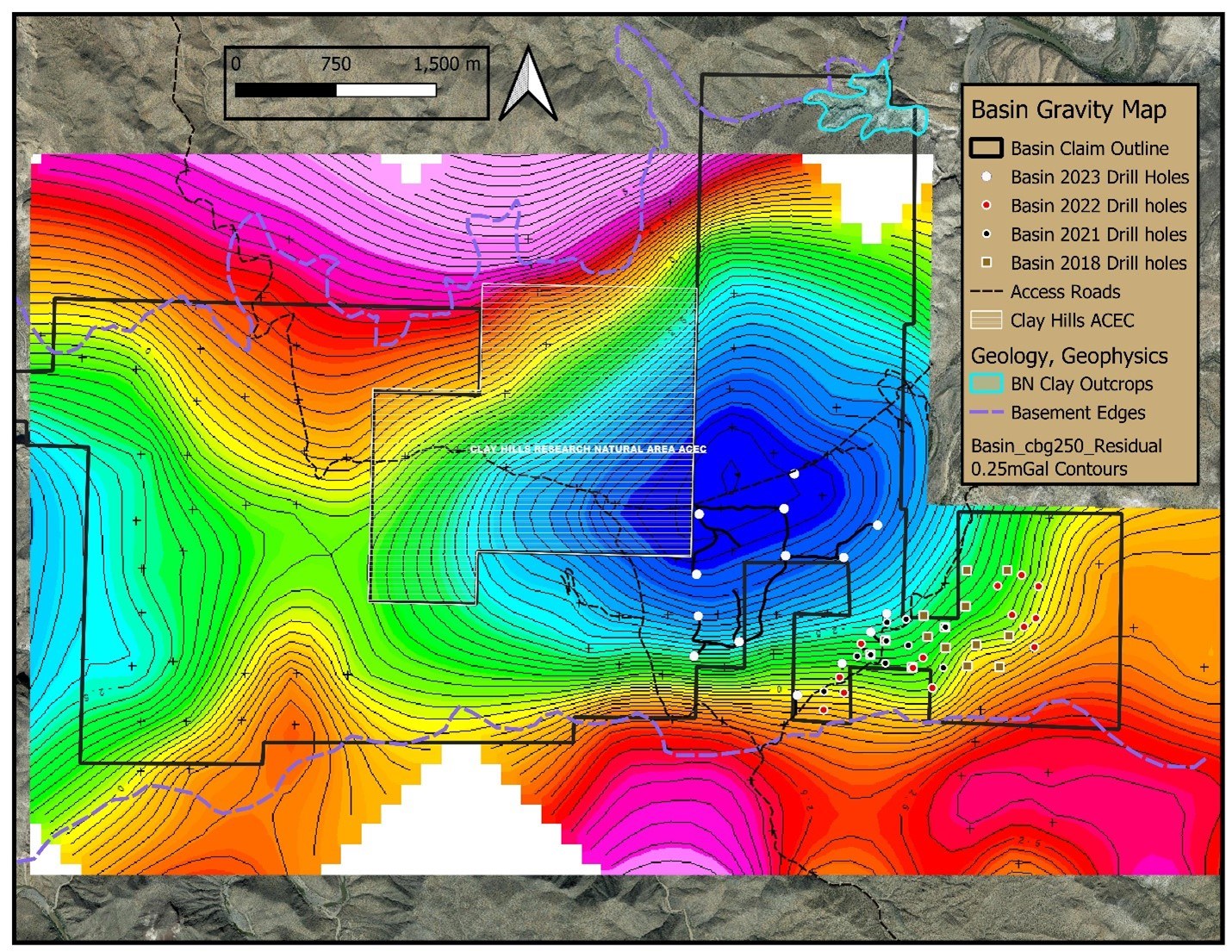
The Company conducted GPR (ground penetrating radar) in late 2021. The GPR survey lines were conducted over roads and known clay outcrops to determine signatures and characteristics of the subsurface throughout the property. The GPR sees about 70 to 90m below the surface. Clay targets were interpreted by the surveyor and have been verified by drilling on Basin East. Additional targets are found on Basin West and will be the focus of future drilling when permits have been granted.
A 130-station gravity survey was conducted in 2023, covering the majority of the Basin project. The survey was designed to identify basin bounding or intra-basin faults, but ultimately identified a deep basin feature in the center of Basin North, interpreted to represent the deepest basement (Precambrian) rock and theoretically, the thickest part of the sedimentary sequence. Drilling has confirmed the thickest clay sequences roughly correlate to the gravity low.
Geology/Stratigraphy
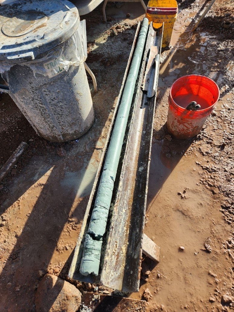
The mineralized sequence at Basin consists of an Upper Clay and Lower Clay, separated by roughly 15-25m of lapilli tuff. The 2023 drilling programme discovered the upper clay increases in thickness from south to north, having an average thickness of 34m in Basin East, then rapidly increases thickness to 80m as drilling continued to the north and open to the west, north, and east. Further drilling towards the north encountered the thickest Upper Clay sequence at 130m. Within the Upper Clay is a high grade interval of 15 to 28m in thickness and lithium values average 1,300ppm. coincident to this high-grade horizon is anomalous molybdenum that averages approximately 100ppm over the property, increasing towards the north and locally up to 641ppm.
The Lower Clay is most prominent over Basin East and was partially drilled to the north due to a focusing on the Upper Clay. The Lower Clay ranges in thickness of 35 to 45m and has lithium grades ranging from 600 to 1,100ppm with an average of 725ppm. Drilling towards the north continued to encounter Lower Clay, discovering extensive lateral continuity of the clay horizon and contributes to the mineral resource estimation.
The perimeter of the property to the north and south is Precambrian basement granites and granodiorite, although young Miocene rhyolite domes and tuffs are located directly to the west and young Pliocene basalt flows are notably present to the east.


Updated 2024 Mineral Resource Estimate
Classification | Domain | Tonnes | Mean Grade | Contained Metal | ||
Mt | Li (ppm) | LCE (kt) | ||||
Measured | Upper Clay | 13 | 720 | 48 | ||
Upper Clay HG | 7 | 1,316 | 49 | |||
Lower Clay | 1 | 687 | 2 | |||
SubTotal | 20 | 929 | 99 | |||
Indicated | Upper Clay | 90 | 794 | 382 | ||
Upper Clay HG | 18 | 1302 | 126 | |||
Lower Clay | 14 | 713 | 52 | |||
SubTotal | 122 | 860 | 560 | |||
Inferred | Upper Clay | 316 | 741 | 1,246 | ||
Upper Clay HG | 90 | 1,154 | 555 | |||
Lower Clay | 92 | 709 | 348 | |||
SubTotal | 499 | 810 | 2,150 | |||
- Mineral Resource statement has an effective date of 2 July 2024.
- The Mineral Resource is reported using a cut-off grade of 550 ppm Li and is constrained to an optimised open pit shell, which was generated using the following assumptions: lithium carbonate metal prices of 17,200 USD/tLCE; State of Arizona royalty (selling cost) of 6%; operating costs of 35 USD/ tore; Li recovery of 72%; mining dilution and recovery of 0% and 100%; and pit slope angle of 45°.
- Tonnages are reported in metric units.
- Rounding as required by reporting guidelines may result in apparent summation differences between tonnes, grade and contained metal content which are not considered material.
- Conversion factor of Li metal to lithium carbonate equivalent (LCE) = 5.323
- The figures above are reported on a gross basis given Bradda’s 100% interest in the property

Updated 2023 Mineral Resource Estimate
Classification | Domain | Tonnes | Mean Grade | Contained Metal | ||
Mt | Li (ppm) | K (%) | LCE (kt) | K (kt) | ||
Indicated | Upper Clay | 11 | 720 | 3.5 | 42 | 380 |
Upper Clay HG | 6 | 1350 | 3.2 | 43 | 190 | |
Lower Clay | - | - | - | - | - | |
SubTotal | 17 | 940 | 3.4 | 85 | 570 | |
Inferred | Upper Clay | 143 | 790 | 2.7 | 600 | 3,800 |
Upper Clay HG | 48 | 1290 | 3.1 | 330 | 1,500 | |
Lower Clay | 19 | 690 | 2.8 | 70 | 530 | |
SubTotal | 210 | 900 | 2.8 | 1,000 | 5,800 | |
- Mineral Resource statement has an effective date of 1 September 2023.
- The Mineral Resource is reported using a cut-off grade of 550 ppm Li and is constrained to an optimised open pit shell, which was generated using the following assumptions: lithium carbonate metal prices of 22,000 USD/tLCE; State of Arizona royalty (selling cost) of 6%; operating costs of 40 USD/ tore; Li recovery of 72%; mining dilution and recovery of 0% and 100%; and pit slope angle of 45°.
- Tonnages are reported in metric units.
- Rounding as required by reporting guidelines may result in apparent summation differences between tonnes, grade and contained metal content which are not considered material.
- Conversion factor of Li metal to lithium carbonate equivalent (LCE) = 5.323
- The figures above are reported on a gross basis given Bradda’s 100% interest in the property
HIGH GRADE
Over one quarter of the contained LCE is in a High-Grade zone within the Upper Clay zone with an average grade of some 1,200 ppm Li. This High-Grade zone gives Bradda Head further optionality and could have important economic implications for a potential future mining operation. The shallow nature of the High-Grade zone, which crops out in Basin East, would likely result in a low strip ratio, enabling High-Grade ore to be scheduled early in a possible mine plan as it sits in the upper part of the deposit.
EXPLORATION POTENTIAL
The Upper Clay zone and Higher-Grade zone show remarkable extent and continuity throughout the drilled parts of the Basin Project and remain open to the north, indicating significant exploration potential in the Basin North license. Geological mapping, surface samples assayed for lithium, and geophysical (Ground Penetrating Radar) survey work also indicate similar clay layers are likely present throughout the majority of the Basin West license area.
As such, with further wide-spaced drilling Bradda Head sees excellent potential to increase the resource base substantially with the goal of far exceeding 2.81MT LCE we currently have. Extensive potential exists at Basin West, Basin West Extension and Basin North claims based upon geological mapping and surface geochemistry.
NEXT DRILLING STEPS
Permitting continues with the BLM on the Basin West Exploration Plan of Operations (EPO). The permit has commenced through the EA (Environmental Assessment) process and we continue to monitor progress with permit approvals through the NEPA process. Phase 1 of the EPO will consist of drilling 52 drill holes, designed to test broad areas in which mapping and surface sampling found lithium-bearing clay at surface. Metallurgical testing will be completed on splits of the cores.
A metallurgical study is planned, which may lead to the development of a maiden PEA.
Basin West
Basin West
Basin West Project (BWP) which combines Bradda’s Basin West (BW) Basin West Extension (BWE) claims is located in central-western Arizona, USA. The project consists of 130 placer mining claims and 141 lode mining claims on land administered by the Bureau of Land Management (BLM), covering a total area of 11km2.
Project Highlights
- Extensive, 11.2km2 group of mining claims, widespread clay exposure with highly elevated lithium in surface samples.
- Surface collected gravity and GPR data indicate shallow clays in numerous locations throughout the claims and gravity
- Surface geochemistry of clay outcrops contain widespread and strongly elevated lithium values up to 1,680ppm


Our Projects
Arizona
Sedimentary projects:
Basin and Wikieup Sedimentary Lithium projects
Our Projects
Arizona
Pegmatite projects:
San Domingo Lithium Pegmatite district
Our Projects
Nevada
Brine projects:
Wilson and Eureka Lithium Brine projects